What Is Invest 92L Explained With Science And Forecast Insights

Meteorologists worldwide are now closely monitoring Invest 92L, a tropical system that holds the potential to evolve into a significant weather threat. The term "Invest" marks the first official step in tracking systems that may develop into cyclones, hurricanes, or other severe storms, but what exactly does it mean and why does it matter. Unlike named storms, Invest systems like 92L remain under observation until they meet specific criteria set by agencies such as the National Hurricane Center, creating a period of uncertainty that demands public and scientific attention.
Invest 92L is more than just a numerical designation—it represents a critical phase in tropical weather forecasting where environmental conditions, ocean temperatures, and atmospheric patterns converge to determine the system’s future trajectory. Understanding its formation, potential hazards, and the tools used to track it is essential for coastal communities, emergency responders, and even global supply chains vulnerable to disruptions. From the warm waters fueling its growth to the complex models predicting its path, every factor plays a role in shaping whether Invest 92L will fade into obscurity or intensify into a storm requiring urgent preparedness.
Understanding Invest 92L: Meteorological Classification and Development Stages

The designation "Invest 92L" marks a critical phase in the lifecycle of potential tropical cyclones, where meteorologists begin systematic monitoring of a system exhibiting early signs of organization. This label signifies the initiation of detailed analysis by agencies like the National Hurricane Center (NHC) and other global meteorological bodies to determine whether the system will evolve into a tropical depression, storm, or hurricane. The classification process relies on a combination of wind speed thresholds, atmospheric pressure trends, and structural organization observed through satellite data, buoy networks, and advanced modeling. Understanding these stages and criteria is essential for accurate forecasting and public preparedness, as Invest systems can rapidly intensify or dissipate based on environmental conditions.
Meteorological Definition of "Invest" and Its Role in Tropical System Tracking
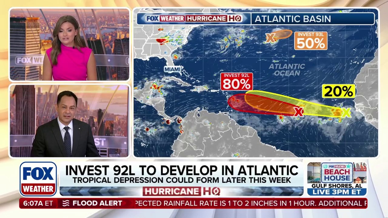
The term "Invest" originates from the Investigation designation used by the National Hurricane Center (NHC) and other regional specialized meteorological centers (RSMCs) to identify areas of disturbed weather requiring close monitoring. When a system exhibits potential for tropical cyclone formation, it is assigned an "Invest" number (e.g., 92L, 93L) to facilitate standardized tracking and data collection. This system was formalized in the 1990s as part of improvements to the Global Tropical Cyclone Operational Plan, enabling better coordination between agencies like the Japan Meteorological Agency (JMA), Met Éireann (Ireland), and the Australian Bureau of Meteorology (BoM).
Invest designations are not official tropical cyclone classifications but serve as preliminary identifiers for systems meeting specific criteria: - Low-pressure systems with organized convection (thunderstorm activity). - Sustained winds below tropical depression thresholds (≤33 knots or 38 mph). - Potential for development within 48 hours, as assessed by meteorologists using satellite imagery, scatterometer data, and numerical models.
The Invest process ensures that all potential threats are evaluated systematically, reducing the risk of missed forecasts. For example, Invest 99L (2017), which later became Hurricane Irma, was initially tracked as a disorganized wave before rapidly intensifying into a catastrophic Category 5 storm.
Table of Contents
- Understanding Invest 92L: Meteorological Classification and Development Stages
- Meteorological Definition of "Invest" and Its Role in Tropical System Tracking
- Classification Process: From Invest to Tropical Cyclone
- Tools and Data Used to Assess Invest 92L’s Development Potential
- Historical Evolution of the Invest System and Its Forecasting Impact
- Formation and Development Factors of Invest 92L
- Oceanic Conditions: Sea Surface Temperatures and Latent Heat Dynamics
- Atmospheric Moisture and Instability: The Role of Mid-Level Humidity
- Vertical Wind Shear: The Double-Edged Sword of Storm Organization
- Large-Scale Atmospheric Waves: MJO, African Easterly Waves, and Tropical Waves
- Potential Impacts and Hazards Associated with Invest 92L
- Heavy Rainfall and Flooding Mechanisms
- Storm Surge Formation and Coastal Vulnerabilities
- Tornadoes and Wind Damage in Tropical Disturbances
- Geographical Breakdown of Affected Regions
- Interactive Hazard Comparison Table
- Tracking and Forecasting Invest 92L: Tools and Techniques
- Numerical Weather Prediction Models in Forecasting Invest 92L
- Ensemble Forecasting and Its Role in Improving Predictions
- Creating the Cone of Uncertainty for Invest 92L
- Real-Time Tracking Tools for Invest 92L
- Interpreting Spaghetti Plots and Reconciling Model Discrepancies
- Challenges in Forecasting Rapid Intensification of Invest Systems
Classification Process: From Invest to Tropical Cyclone
The progression of a system like Invest 92L through tropical cyclone stages is governed by strict meteorological criteria, primarily sustained wind speeds and central pressure measurements. The National Hurricane Center (NHC) and World Meteorological Organization (WMO) define these thresholds to ensure consistency in global reporting. Below is the stage-by-stage breakdown of classification, including wind speed and pressure benchmarks:
| System Stage | Sustained Wind Speed | Central Pressure (mb) | NHC Classification Criteria | Potential Hazards Associated |
|---|---|---|---|---|
| Invest | ≤33 knots (38 mph / 62 km/h) | ≥1010 mb (varies) | Disorganized convection with potential for development within 48 hours; no closed circulation. | Heavy rainfall, localized flooding, gusty winds (if convection is intense). |
| Tropical Depression | 34–38 knots (39–46 mph / 63–74 km/h) | 1009–1000 mb | Closed low-level circulation with organized thunderstorms; sustained winds ≥34 knots. | Increased rainfall, storm surges (minor), coastal flooding. |
| Tropical Storm | 39–63 knots (46–73 mph / 74–118 km/h) | 999–980 mb | Well-defined circulation with sustained winds ≥39 knots; named by NHC/WMO. | Damaging winds, heavy rainfall, tornadoes (rare), storm surges. |
| Hurricane (Typhoon/Cyclone) | ≥64 knots (74 mph / 119 km/h) | ≤980 mb (major hurricanes: ≤965 mb) | Tightly organized system with sustained winds ≥64 knots; categorized 1–5 (Saffir-Simpson Scale). | Catastrophic wind damage, life-threatening storm surges, widespread flooding. |
The transition from Invest to Tropical Depression occurs when a closed low-level circulation forms, accompanied by persistent thunderstorm activity. Meteorologists use the Dvorak Technique, a satellite-based analysis method, to estimate central pressure and wind speeds before direct measurements (e.g., from hurricane hunter aircraft) are available. For instance, Invest 91L (2019), which became Hurricane Dorian, was upgraded to a tropical depression after satellite imagery revealed a well-defined eye-like feature and sustained winds near 35 knots.
Tools and Data Used to Assess Invest 92L’s Development Potential
Meteorologists employ a multi-tiered approach to evaluate whether an Invest system like 92L will strengthen, weaken, or remain disorganized. The primary tools include:
- Geostationary and Polar-Orbiting Satellites Satellites like GOES-16 (NOAA) and Himawari-8 (JMA) provide real-time infrared and visible imagery to assess: - Cloud top temperatures (colder clouds indicate stronger updrafts). - Outflow patterns (high-altitude winds that remove rising air, aiding development). - Banding features (spiral rainbands signifying organization). For example, Invest 90L (2020), which became Hurricane Sally, showed pronounced banding on satellite imagery 24 hours before upgrading to a tropical depression.
- Scatterometer Data (e.g., ASCAT, QuikSCAT) These instruments measure surface wind speeds over the ocean, critical for verifying whether a system meets tropical depression thresholds. A scatterometer pass over Invest 92L could reveal gusty winds near 30 knots, suggesting early development.
- Buoy and Ship Reports NOAA buoys and voluntary observing ships (VOS) provide in-situ measurements of pressure, temperature, and wave height. During Invest 98L (2018), buoy data confirmed a pressure drop below 1005 mb, supporting the NHC’s decision to classify it as a tropical depression.
- Numerical Weather Prediction (NWP) Models Models like the GFS (Global Forecast System), ECMWF (European Model), and HMON (Hurricane Multi-scale Ocean-coupled Non-hydrostatic model) simulate a system’s pressure trends, wind fields, and track. For Invest 92L, if models consistently show rapid pressure falls and increasing wind radii, the NHC may issue a Tropical Cyclone Formation Alert (TCFA). - Example: The 2017 Atlantic season saw Invest 93L (later Hurricane Harvey) forecasted to intensify by multiple models, prompting early warnings for Texas.
- Atmospheric Soundings and Upper-Air Data Radiosondes (weather balloons) and aircraft reconnaissance (e.g., NOAA P-3 flights) measure humidity, wind shear, and instability in the atmosphere. High mid-level humidity and low vertical wind shear favor tropical development. In Invest 95L (2016), which became Hurricane Matthew, upper-air data revealed exceptionally low shear, contributing to its rapid intensification.
Historical Evolution of the Invest System and Its Forecasting Impact
The Invest designation was introduced in the late 1990s as part of efforts to standardize global tropical cyclone tracking under the WMO’s Tropical Cyclone Program. Before this, systems were often monitored informally, leading to inconsistent naming and delayed warnings. The Invest system addressed these gaps by: - Providing a unique identifier for each potential system, reducing confusion in multi-agency coordination. - Enabling early public advisories even before a system reached
Formation and Development Factors of Invest 92L
The development of Invest 92L—a designated tropical weather system under investigation by meteorological agencies—depends on a delicate interplay of oceanic and atmospheric conditions. Unlike spontaneous weather disturbances, these systems require specific thresholds in sea surface temperatures (SSTs), atmospheric moisture, and wind patterns to transition from disorganized cloud clusters into organized tropical cyclones. Understanding these factors reveals why some systems thrive while others dissipate, offering critical insights for forecasting and disaster preparedness. The role of large-scale atmospheric waves, such as the Madden-Julian Oscillation (MJO) and African Easterly Waves, further complicates this process, acting as either catalysts or inhibitors for cyclogenesis. Meanwhile, climate change introduces additional variables, altering the baseline conditions that historically governed tropical storm formation.
Oceanic Conditions: Sea Surface Temperatures and Latent Heat Dynamics
The foundation of tropical cyclone development lies in warm ocean waters, which provide the primary energy source through latent heat release. For Invest 92L to intensify, sea surface temperatures (SSTs) must exceed 26.5°C (79.7°F), extending to a depth of at least 50 meters (164 feet) to sustain convection. This threshold ensures that evaporating seawater supplies sufficient moisture to fuel thunderstorm activity within the system’s core. The process begins when warm, moist air rises from the ocean surface, condensing into clouds and releasing latent heat—a mechanism described by the Coriolis effect, which organizes the system’s rotation. Studies from the NOAA Atlantic Oceanographic and Meteorological Laboratory (AOML) indicate that a 1°C increase in SSTs can enhance storm intensity by 10–15%, demonstrating the sensitivity of tropical systems to oceanic heat content.
A deeper layer of warm water, known as the oceanic mixed layer, is equally critical. Shallow warm layers (e.g., <25 meters) can lead to upwelling during storm passage, rapidly cooling the surface and weakening the system—a phenomenon observed in Hurricane Patricia (2015) before its landfall. Conversely, deeper warm layers allow sustained energy transfer, as seen in Super Typhoon Haiyan (2013), which maintained strength over prolonged periods due to a 70-meter-deep warm layer. The interaction between SSTs and storm structure can be visualized through the following heat exchange cycle:
Latent Heat Release Cycle in Tropical Cyclones 1. Warm ocean water evaporates, supplying moist air to the system. 2. Rising moist air condenses into clouds, releasing latent heat (~600 calories per gram of water vapor). 3. Released heat warms the surrounding air, lowering surface pressure and strengthening winds. 4. The cycle repeats, creating a self-sustaining feedback loop if conditions remain favorable.
Atmospheric Moisture and Instability: The Role of Mid-Level Humidity
While warm SSTs initiate development, atmospheric moisture and instability determine whether Invest 92L can organize into a closed circulation. Dry air, particularly in the mid-levels (500–700 mb), acts as a disruptor by increasing entrainment—the mixing of dry air into the storm’s core, which suppresses convection. The Saharan Air Layer (SAL), a mass of dry, dust-laden air originating over the Sahara Desert, frequently inhibits Atlantic tropical development by introducing relative humidity levels below 50% into the system’s environment. For example, Invest 92L in 2020 faced significant delays in organization due to SAL intrusion, despite favorable SSTs.
Conversely, high moisture levels (>65% relative humidity) in the lower and mid-atmosphere enhance instability, fostering thunderstorm development. The K-index and Convective Available Potential Energy (CAPE) metrics are used to quantify this instability, with values exceeding 30–35 units indicating a high potential for organized convection. Additionally, upper-level outflow channels—regions where air diverges away from the storm—must be well-established to allow rising air to escape, preventing the system from becoming choked by its own precipitation. Poor outflow, often caused by strong upper-level troughs, can lead to ventilation issues, as observed in Invest 98L (2017), which failed to intensify despite warm SSTs due to restricted outflow.
Vertical Wind Shear: The Double-Edged Sword of Storm Organization
Vertical wind shear—the change in wind speed and direction with altitude—plays a pivotal role in determining whether Invest 92L develops symmetrically or remains disorganized. Shear values exceeding 20 knots (23 mph) typically disrupt tropical cyclones by tilting the storm’s structure, separating the mid-level circulation from the surface center. This misalignment inhibits the eyewall replacement cycles critical for intensification. For instance, Hurricane Earl (2010) encountered 40+ knots of shear in the Caribbean, leading to a disheveled structure before emerging into a more favorable environment.
However, light to moderate shear (5–15 knots) can paradoxically enhance development by ventilating the storm’s core, removing excess moisture and allowing deeper convection to persist. This dynamic was evident in Hurricane Dorian (2019), which intensified rapidly under 10–15 knots of shear due to improved outflow. The shear-ventilation hypothesis suggests that optimal shear conditions (10–20 knots) can strengthen a storm’s inner core by promoting asymmetric convection that later organizes into a symmetric eyewall.
The following table summarizes the impact of vertical wind shear on Invest 92L’s development:
| Shear Intensity | Effect on Storm Structure | Example Cases |
|---|---|---|
| < 5 knots | Minimal disruption; symmetric development possible if other factors favor growth. | Invest 90L (2016) – Developed into Hurricane Matthew under low shear. |
| 5–15 knots | Moderate ventilation; may enhance inner-core organization if moisture is sufficient. | Hurricane Dorian (2019) – Rapid intensification under 10–15 knots of shear. |
| 15–25 knots | Disruption of mid-level circulation; potential for asymmetric development. | Invest 98L (2017) – Failed to organize due to persistent shear. |
| > 25 knots | Severe tilting; high likelihood of dissipation or weakening. | Hurricane Earl (2010) – Disorganized structure in the Caribbean. |
Large-Scale Atmospheric Waves: MJO, African Easterly Waves, and Tropical Waves
The initiation of Invest 92L is often tied to large-scale atmospheric waves, which provide the initial vorticity (spin) necessary for cyclogenesis. The Madden-Julian Oscillation (MJO)—an eastward-moving disturbance in tropical winds and rainfall—plays a dominant role by modulating moisture and instability across the tropics. During the active MJO phase (Phases 1–4), enhanced convection and reduced shear in the Atlantic and Pacific basins create favorable conditions for tropical development. For example, the 2020 Atlantic hurricane season saw record activity partly due to a prolonged MJO phase 1, which suppressed shear and increased moisture availability.
African Easterly Waves (AEWs), originating from the Sahel region of Africa, are another critical trigger for Atlantic cyclones. These waves, embedded within the African Easterly Jet (AEJ), propagate westward into the Caribbean and Atlantic, where they interact with warm SSTs to form tropical waves. Approximately 60% of major Atlantic hurricanes trace their origins to AEWs, including Hurricane Katrina (2005) and Hurricane Irma (2017). The National Hurricane Center (NHC) monitors AEWs using satellite imagery and model outputs, such as the GFS and ECMWF, to predict their potential for cyclogenesis.
Other tropical waves, such as easterly waves in the Pacific or monsoon trough disturbances, also contribute to Invest system formation. In the Pacific basin, Kelvin waves and Rossby waves can interact with existing disturbances, leading to offshore development (e.g., Hurricane Lane (2018
Potential Impacts and Hazards Associated with Invest 92L
Invest 92L, like other tropical disturbances, poses a multifaceted threat to coastal and inland regions through a combination of meteorological hazards. Heavy rainfall, storm surge, flooding, and tornadoes are among the primary risks, each driven by distinct atmospheric and geographical factors. Understanding these hazards—how they form, their geographical impact, and the vulnerabilities of affected areas—is critical for preparedness. Historical data from similar systems, such as Tropical Storm Imelda (2019) and Hurricane Harvey (2017), underscore the devastating potential of these phenomena when conditions align. Below is a detailed breakdown of the hazards linked to Invest 92L, their mechanisms, and the regions most at risk.
Heavy Rainfall and Flooding Mechanisms
Heavy rainfall associated with Invest 92L arises from deep convective bands fueled by warm ocean waters and moist atmospheric conditions. These bands, often organized into spiral structures, release precipitation rates exceeding 100 mm (4 inches) per hour in intense bursts. The banding structure of tropical systems concentrates rainfall along specific paths, increasing localized flooding risks. When Invest 92L stalls or moves slowly—common in steering environments with weak upper-level winds—prolonged exposure to heavy rain elevates the threat of flash flooding and riverine flooding.
Terrain and urbanization exacerbate these risks. Mountainous regions, such as those in Central America or the U.S. Gulf Coast, experience orographic enhancement, where moist air is forced upward, condensing into even heavier rainfall. Urban areas with impervious surfaces (e.g., concrete, asphalt) accelerate runoff, overwhelming drainage systems. For instance, Hurricane Harvey (2017) produced 150 cm (60 inches) of rainfall in Texas, with Houston’s flat terrain and extensive urbanization contributing to catastrophic flooding. Similarly, Tropical Storm Imelda (2019) caused 114 cm (45 inches) of rain in Eastern Texas, leading to $5 billion in damages and displacing thousands.
Flash flooding occurs within hours of intense rainfall, particularly in low-lying or poorly drained areas. Riverine flooding, however, develops over days as sustained rainfall saturates soil and fills waterways beyond capacity. The National Weather Service (NWS) categorizes flood risks using the Flash Flood Guidance (FFG), which estimates how much rain a watershed can absorb before flooding occurs. In coastal plains, such as the Mississippi Delta or Northern Mexico, slow-moving systems like Invest 92L could trigger areal flooding, where large swaths of land remain submerged for weeks.
Storm Surge Formation and Coastal Vulnerabilities
Storm surge—the abnormal rise of seawater due to a storm’s wind and pressure—represents one of the deadliest hazards of tropical systems. It forms when strong onshore winds push water toward the coast, while the low-pressure center of Invest 92L further elevates sea levels. The surge height depends on: - Storm intensity (higher winds increase surge). - Storm size (larger systems displace more water). - Bathymetry (shallow continental shelves amplify surge). - Tidal cycles (surge coincides with high tide, worsening flooding).
Low-lying coastal communities, particularly in bays, estuaries, and barrier islands, face the highest risks. For example, Hurricane Katrina (2005) combined a 28-foot storm surge with levee failures, submerging 80% of New Orleans and causing 1,800+ fatalities. Similarly, Hurricane Ian (2022) produced a 15-foot surge in Fort Myers, Florida, destroying homes and infrastructure along the Gulf Coast.
The Saffir-Simpson Hurricane Wind Scale does not account for storm surge, yet it remains a leading killer in tropical cyclones. Bathymetry plays a critical role: shallow offshore depths, like those near Galveston, Texas, or Tampa Bay, Florida, can double surge heights. Additionally, wind setup (water piling up against the coast) and wave action (breaking waves eroding defenses) compound the threat. The National Hurricane Center (NHC) issues Storm Surge Watches/Warnings based on Potential Storm Surge Flooding (PSS) maps, which model surge risks under different scenarios.
Tornadoes and Wind Damage in Tropical Disturbances
Invest 92L may spawn tornadoes, particularly in the right-front quadrant of the system where wind shear is strongest. These tornadoes are often EF0-EF2 but can reach EF3 intensity, as seen with Hurricane Ivan (2004), which produced 120 tornadoes across the U.S. Southeast. The primary mechanisms include: - Mesovortices (small, intense rotating circulations within the storm). - Outer rainbands (where cold, dry air interacts with moist, warm air). - Landfall interactions (friction over land destabilizes the atmosphere).
Wind damage from Invest 92L will vary with intensity, following the Saffir-Simpson Scale (Category 1–5), but real-world impacts depend on duration, forward speed, and terrain. For instance: - Category 1 winds (74–95 mph) can uproot trees and damage mobile homes. - Category 3+ winds (111+ mph) cause catastrophic structural failure, as seen in Hurricane Michael (2018), which leveled entire neighborhoods in Mexico Beach, Florida.
However, the scale has limitations: - Size matters: A larger storm with weaker winds (e.g., Hurricane Sandy, 2012) can cause more destruction than a smaller, intense hurricane. - Terrain effects: Mountainous regions (e.g., Appalachians) experience wind acceleration, increasing localized damage. - Infrastructure resilience: Older buildings or poorly constructed homes suffer more, even under lower-category winds.
Secondary wind effects include debris projectiles, which account for ~10% of hurricane-related fatalities, and downed power lines, leading to prolonged outages. The FEMA P-361 report estimates that wind-driven rain (not just wind speed) contributes significantly to roof failures and water intrusion.
Geographical Breakdown of Affected Regions
Invest 92L’s potential impacts will vary by region based on proximity to the coast, topography, and population density. Below is a geographical vulnerability assessment:
| Region | Primary Hazards | Vulnerability Factors | Historical Examples |
|---|---|---|---|
| U.S. Gulf Coast | Storm surge, heavy rain, tornadoes | Low-lying coastlines, urbanized drainage systems, shallow continental shelf | Hurricane Katrina (2005), Hurricane Ida (2021) |
| Texas Coastal Plains | Flash flooding, riverine flooding | Flat terrain, high population density, frequent slow-moving storms | Tropical Storm Imelda (2019) |
| Florida Peninsula | Storm surge, wind damage | Long coastline, high vulnerability to surge in bays (e.g., Tampa Bay, Charlotte Harbor) | Hurricane Ian (2022) |
| Southeastern U.S. | Tornadoes, prolonged rainfall | High wind shear, dense population in tornado-prone areas (e.g., Alabama, Georgia) | Hurricane Ivan (2004) |
| Central America | Mudslides, catastrophic flooding | Steep terrain, deforestation, poor infrastructure in rural areas | Hurricane Mitch (1998) |
| Northeastern Mexico | Storm surge, coastal flooding | Shallow bays (e.g., Tampico), limited evacuation infrastructure | Hurricane Alex (2010) |
| Inland (Mississippi Valley) | Riverine flooding | Drainage basins (e.g., Atchafalaya, Red River), agricultural land susceptible to inundation | Mississippi River floods (2019) |
Coastal regions face immediate threats from surge and wind, while inland areas risk prolonged flooding due to slow-moving systems. Urban centers with aging infrastructure (e.g., New Orleans, Miami) are particularly vulnerable to secondary effects, such as power outages and economic disruptions.
Interactive Hazard Comparison Table
Below is a structured comparison of Invest 92L’s primary hazards, their mechanisms, affected areas, and mitigation strategies:
| Hazard Type | Tracking and Forecasting Invest 92L: Tools and Techniques
Accurate forecasting of Invest 92L relies on a sophisticated integration of numerical modeling, real-time observational data, and meteorological expertise. The evolution of a tropical system from an Invest designation to a potential cyclone demands precise tracking to assess its trajectory, intensification, and potential hazards. Meteorologists leverage a combination of global and regional numerical weather prediction (NWP) models, satellite technology, and in-situ measurements to refine predictions. These tools collectively mitigate uncertainties, though challenges such as rapid intensification or data scarcity in remote oceanic regions persist. Understanding the methodologies behind forecasting ensures stakeholders can interpret official advisories with clarity and act on critical warnings effectively.
Numerical Weather Prediction Models in Forecasting Invest 92LNumerical weather prediction models simulate atmospheric conditions to project the behavior of tropical systems like Invest 92L. Key models, including the Geophysical Fluid Dynamics Laboratory (GFDL), Hurricane Weather Research and Forecasting (HWRF), and European Centre for Medium-Range Weather Forecasts (ECMWF), provide varying strengths in resolving storm dynamics. The GFDL model, developed by NOAA, excels in capturing the thermodynamic structure of tropical cyclones but may underperform in weaker or disorganized systems. HWRF, designed specifically for hurricane forecasting, incorporates high-resolution data and nested grids to improve track and intensity predictions, though it occasionally overestimates rapid intensification due to its fine-scale resolution. The ECMWF, renowned for its global accuracy, offers a broader atmospheric context but may lag in regional tropical cyclone specifics. Each model’s limitations are counterbalanced by ensemble techniques, where multiple simulations account for initial condition uncertainties, thereby enhancing forecast reliability.Ensemble Forecasting and Its Role in Improving PredictionsEnsemble forecasting involves running multiple variations of a model with slight perturbations in initial conditions or model physics to generate a range of potential outcomes. For Invest 92L, this approach is critical because small errors in early-stage data can lead to significant discrepancies in later-stage predictions. For instance, the National Hurricane Center (NHC) utilizes the GEFS (Global Ensemble Forecast System) and HWRF ensemble to produce probabilistic track and intensity forecasts. These ensembles reveal consensus regions among models, highlighting the most likely storm paths while identifying outliers. The spread of ensemble members also quantifies uncertainty, with tighter clusters indicating higher confidence in the forecast. By analyzing ensemble mean tracks and spaghetti plots (visual representations of individual model forecasts), meteorologists refine their predictions, reducing the risk of misleading deterministic forecasts.Creating the Cone of Uncertainty for Invest 92LThe cone of uncertainty is a graphical tool used to communicate the potential track of Invest 92L over the next five days, accounting for forecast errors observed in past storms. The cone is constructed using the average error distance of previous forecasts at each time interval, typically expanding outward to reflect increasing uncertainty over time. For example, at 72 hours, the cone may span 200 nautical miles, while at 120 hours, it widens to 300 nautical miles. Key components of the cone include:Real-Time Tracking Tools for Invest 92LReal-time data collection is essential for monitoring Invest 92L’s development and trajectory. Meteorologists rely on a suite of tools, each offering unique insights into the system’s structure and environment. Below is a comparative analysis of these tools:
Interpreting Spaghetti Plots and Reconciling Model DiscrepanciesSpaghetti plots are visual representations of individual model forecasts for Invest 92L, where each line corresponds to a different model’s predicted track. Meteorologists analyze these plots to identify:Challenges in Forecasting Rapid Intensification of Invest SystemsRapid intensification (RI), defined as an increase in maximum sustained winds of at least 35 knots (40 mph) in 24 hours, poses a significant forecasting challenge for Invest systems like 92L. Factors contributing to RI include:Accessing and InterpreInvest 92L serves as a reminder of nature’s unpredictable power and the sophisticated science behind tracking tropical systems. From its meteorological classification to the advanced forecasting tools used to anticipate its behavior, every stage of its development offers critical lessons for both experts and the public. As climate patterns continue to shift, understanding how systems like Invest 92L form, intensify, and impact vulnerable regions becomes increasingly vital. Whether it dissipates harmlessly or strengthens into a formidable storm, the insights gained from monitoring it today will shape future preparedness efforts, ensuring communities remain resilient in the face of an ever-changing climate. |
|---|
Leave a Comment
Comments are moderated before appearing. The data you submit is processed according to the Privacy Policy of Velirium.